Site Plan + Terrain Intel
$3,897
Run Your Own Land Due Diligence
The same two tools I use on paid client deals: LiDAR terrain analysis and survey-accurate concept site plans. Yours to run on every parcel you look at.
Stop paying for a site plan on every deal you don’t buy.
Most land deals die on the ground: slope, drainage, power lines, setbacks, dirt work. Finding that out usually means waiting on, and paying for, an engineer, deal after deal. This system lets you find it yourself in an afternoon, before you make an offer.
Two tools, one workflow
Terrain Intel takes any address or parcel and returns USGS LiDAR slope classes, buildable area, drainage paths, flood zone, cut and fill, and the constraints that kill lots.
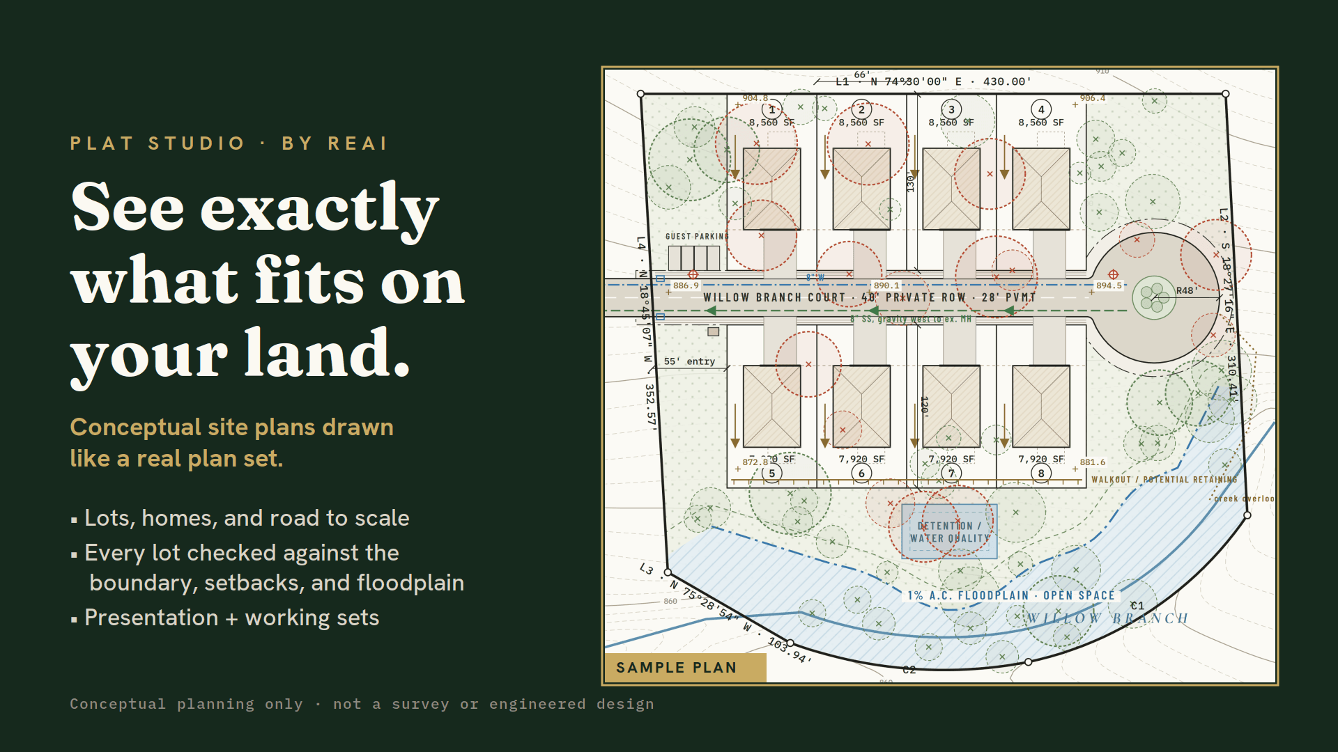
Site Plan (Plat Studio) takes that terrain and turns it into architect-grade concept sheets: lots, homes, driveways, setbacks, utilities and a lot-by-lot table. Every lot is checked in code before it’s drawn.
Why together: the terrain tells the plan where it can’t go, and the plan tells you what the terrain is worth. You get one lot count you can defend, not two reports that disagree.
What you can produce on every deal
A concept site plan set (PDF) with options compared side by side
Slope and constraint maps, plus a 3D view
A lot table: areas, widths, cut, walls, utilities and pass or fail on each lot
A live interactive plan link to send buyers, partners or lenders
DXF files to hand to your engineer
What that does for you
Screen more deals, faster. Kill the bad ones in an afternoon, not after a month of engineering.
Find the lots others miss. One hillside lot went from the architect’s 6 lots to 7 buildable homes, and a power line conflict was caught before anyone designed the 8th.
Offer with confidence. Price the dirt work and the lot count before you sign.
Look like the most prepared person in the room, at the planning office, the lender or the closing table.
Sell it as a service. Run plans for agents, builders and investors in your market.
What’s included
Terrain Intel and Plat Studio set up for you
Onboarding walkthrough and setup guide
[Support or updates term]
Produces concept plans for screening and planning. Not a survey or engineered design. Final approvals and stamped plans come from a licensed engineer and the jurisdiction.